

After a great couple of days up at Uto Peak Mike, Steve and I came back down to the Illecillewaet campground and spent the evening of Sunday, August 1 celebrating our successful climb over burgers and beers at the Glacier Park Lodge. The next morning we had a leisurely breakfast of bacon and eggs and then spent the remainder of the morning repacking our gear for a trip up to Hermit Meadows. The Hermit Meadows Campground is a backcountry campground situated in the North Selkirks slightly east of the Glacier Park Lodge in Glacier National Park. The camp sites are stunning, surrounded by rivers, huge peaks, glaciers and views that go on forever. The only catch is that the campground is at 2100m elevation. The trail head is at 1300m elevation and the trail is 2.8km long. In other words, the only way to get there is to haul your gear up a trail that is equivalent to the Grouse Grind. We were planning to stay in Hermit Meadows from Monday Aug 2 until Sunday Aug 8 so we had to carry up all our camping and climbing gear plus 7 days worth of food. Our packs were weighed somewhere around 55-60 lbs each. It took us 3 hours to hike the 2.8km.


The first night in Hermit Meadows was memorable. After being greeted with the amazing view and lucking out by scoring the best and only campsite up on a ridge (we were the only group up there most of the time apart from a few hikers here and there) we made some KD for dinner and were promptly entertained by a full blown mountain storm. I’ve never seen hail, wind thunder and lightning like that before. It was something else!

The next morning (Tuesday) we got up at 4am to clear skies to make an attempt at climbing Mount Tupper. We attempted the West Ridge of Mount Tupper which is rated PD 5.3 and the summit is at an elevation of 2804m. It is the huge mountain you can see towering over Rogers pass from the Glacier Park Lodge. The climb started with a hike up the “Morraine that never ends” then transitions onto some ledges that must be traversed and then onto a scree slope up that leads to the West Ridge of Tupper. Next you follow the ridge for a long ways climbing on everything from Class 2 hiking to class 4 scrambling. The views of the surrounding peaks and glaciers in behind the ridge are something else. They go on forever! After 3.5 hours from when we left camp we arrived at “The Hermit” which is a sub-peak that must be climbed to get to the summit block of Tupper. We had been warned about not roping up too early on this climb as it takes way too much time, so when we got to the Hermit and were beyond our comfort level of climbing un-roped, we made a decision to turn back. It was just taking us too long to scramble up the fourth class rock and with the history of afternoon thundershowers we did not want to be reaching the summit of Tupper in Mid-afternoon. It was a bit disappointing to not summit, but over all it was a good decision and we still had a great day of climbing, views and playing in the mountains. And above all else it was a good learning experience to figure out our strengths and weaknesses in our climbing skills and figure out where we’re at when it comes grades and comfort levels. At that point we hiked/climbed back down to camp and spent the rest of the afternoon lying in the sun reading in the alpine meadows.
 Mt Tupper


The next day we were all pretty tired from having climbed and hiked for the last 4 days so we took a “rest day” and only hiked a couple thousand feet on Wednesday. We slept in and then in the lat morning hiked up to “Little Sifton”. Little Sifton is a small peak on the South West Ridge of Mount Sifton. It involved mostly hiking, then a bit of scrambling over a talus field and finally some third and fourth class scrambling to reach the summit. It was a great relaxed day of fun hiking and scrambling. We were out for a bout 3 hours and then came back to camp for a shower in the freezing cold creek followed by a nap in the sun.


By Thursday we were all getting pretty fatigued and decided to make it our last day in the Hermit Group since a lot of the peaks were still a bit beyond our comfort level at this point in our climbing careers. But since it was our last day and there was one last area we hadn’t explored we thought we’d go for it. The Rogers/Swiss peaks area is North of the Camp area and directly across a glacier from Mount Tupper. We thought we’d try the 1896 route up Rogers Peak since we thought it was cool that it was named after the same guy who discovered Rogers Pass. The route is rated F, 4th class and the summit elevation is 3169m.
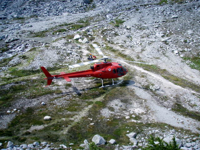
We once again got up at 4am and begain our climb up a bunch of old morraines. These led to some scree slopes and talus fields that started out horrifying but gradually got more pleasant to climb on. Eventually we gained the South East ridge of Rogers. Once we gained the ridge we had the option of continuing up the rock, which is rated at approximately 5.6 (i.e. too hard for us), or step out onto the glacier, cross the bergschrund and climb a steep snow slope to the Rogers-Grant Col. The route description mentioned the snow slope, but not the glacier crossing and we were not really prepared to cross a glacier (which had clear signs of sags and crevasses) so we decided to scramble up a small peak on the ridge instead. We deemed this peak “Little Rogers” and were satisfied with it as our summit that day, climbing to an elevation of approximately 2900m. We spent about an hour enjoying the views and the sun on the peak and then made our way back to camp. On our way back to camp we ran into a couple of park rangers who were doing maintenance at the camp and waiting for a helicopter ride off of the mountain. We tried for a while to convince them to fly us down with them, or at the very least our packs, but they wouldn’t go for it. Worth a shot! Once we got to camp we had some lunch and rested for an hour or so and then packed up camp and headed back down the Hermit trail to the waiting cars. Back at the cars we sorted our gear and parted ways with Steve, bring Leg 2 of our summer adventure to an end.


Full Photo Album is at the following Location:
http://www.flickr.com/photos/37015411@N06/sets/72157624557134641/
No comments:
Post a Comment