Monday, August 30, 2010

Blackcomb Buttress: Our Unicorn!

Last Weekend Mike and I got up bright and early on Sunday morning to head out to Whistler to go for our third attempt to climb the Blackcomb Buttress, a PD, low-5th climbing route to the 8000ft summit of Blackcomb Peak.

A little bit of history: As mentioned above this is the third attempt we've made at climbing Blackcomb Buttress. In theory it shouldn't be too difficult of a route to climb, however the weather never seems to co-operate for us. We made our first attempt on the July long weekend last year (2009) and after spending $40 for a chairlift ride up we hiked to the base of the talus fields and discovered that there was still way too much snow on the route to climb it safely. We spent the day practicing anchor building in the talus field and hiking at Whistler. We went back later that year in August when we were sure that the snow would be gone and we thought we were well prepared. This time we brought a tent and overnight gear and camped out beside Blackcomb lake, right below the buttress in hopes of having an early start and a good weather window in the morning. We went to bed under beautifully clear skies and woke up at 5am to a socked in and mega cloudy day making the decision to go back to sleep for a few hours and then have leisurely hike back to the chairlifts to head home an easy, but disappointing choice to make.


A few pics from our attempt/camp in August 2009:


And that brings us to Sunday's attempt (Take 3). After experiencing how quick it was to hike from the chairlifts to the base of the route at Blackcomb Lake the year before (about 45 min on sidewalk-like trails) we decided to try to climb the peak in one day. According to the ascent times listed in the guide book it should be possible to take the first chairlift up in the morning, climb the mountain and be done in time to catch the last chair lift down that same night. This is, however, a tight window. The first chair up isn't until 10am and the last chair down is at 5pm; the climb is estimated to take 6 hours round trip. This doesn't leave a lot of spare time, however, if you do miss the last chair all it means is a looooong hike down Blackcomb mountain, which sucks, but isn't the end of the world. The downside to doing the route in one day using the chairlifts is that you can not get an early start and weather in the moutnains tends to be better (and safer) early in the morning.


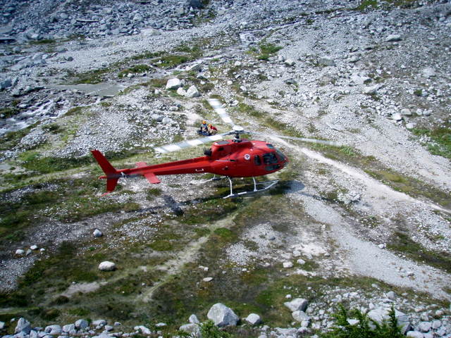
We left North Van at 6:30am on Sunday morning and after a quick breakfast at Timmy's we were on our way to Whistler. We had an uneventful drive along the sea to sky and arrived in Whistler shortly after 8am. Along the way we noticed the weather was deteriorating the further North we went but the forecast had promised no rain until that evening so we thought we'd go for it, even with the dark clouds looming in the distance. We bought our lift tickets, harassed the lifties to let us up the mountain early (to no avail) and grabbed a coffee while we waited for the lifts to officially open. The lifties let us board the chairs at 9:45, 15 min earlier than expected. Every minute counts on this climb so we were happy. The last two times we've been up to Blackcomb Buttress we have taken the Whislter Gondola followed by the Peak to Peak over to Blackcomb. This time however we took the Wizard and Solar Coaster chairs to the top, which turned out to be about 20min faster. We were at the top of the lifts by 10:15 and at Blackcomb Lake (the base of the Buttress) by 10:50am.


Marmot beside Blackcomb Lake


We took a minute here to do some route planning and then we were off and heading up the scree slope to the base of the Bu tress. The scree slope was fairly easy hiking that alternated between loose scree, big rocks and grass/dirt trails. It was steep but not too technical so we could make good time on the approach. It took us about an hour to hike/climb up the approach and reach the start of the 3rd/4th class scrambling. At this point the route quickly went from a reasonably easy hike to fairly technical scrambling. Not having much experience with scrambling or unroped climbing I was a bit uncomfortable ascending this bottom portion of the route as it quickly steepened, which slowed us down a bit. We scrambled over the first few steps unroped and then we harnessed up and short roped the next step.


Approach to the Buttress

At the Base of the Buttress

At this point we were traversing to climbers left to gain the easier rib up the Buttress. We came to a step that was quite steep (almost vertical) where we stopped to reassess. We spent a few minutes deciding if we should rope up and simu-climb this step and this is when the snow started. It was only snowing lightly but the dark clouds in the distance made us decide that we should probably cut our losses before we got into anything too technical. So, once again we turned back and retreated off of Blackcomb Buttress (for the Third time!), officially making it seem incredibly elusive to us, i.e. our Unicorn!


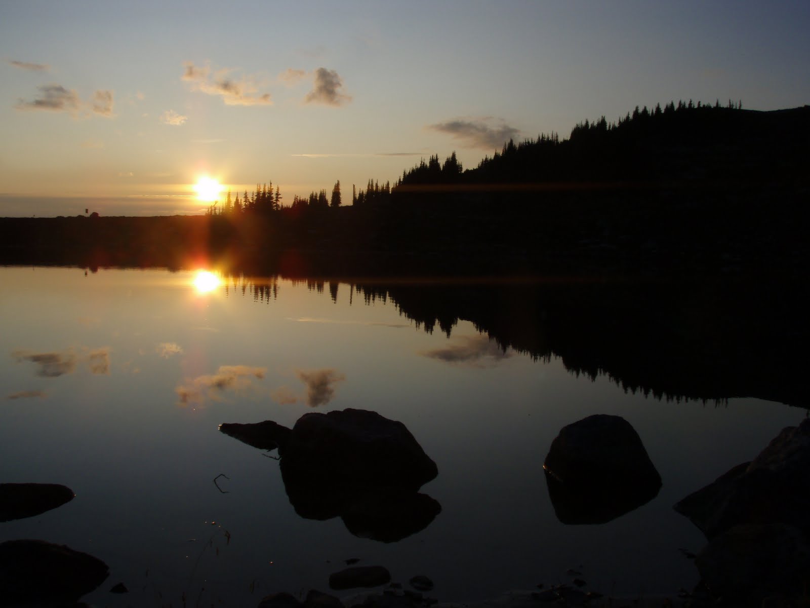
Black Tusk and Bad Weather


We took our time and enjoyed the hike back to the chair lifts and the ride down to the village where we took a stroll through the Whistler Farmer's Market followed by a great dinner of beer and Nachos in Squamish.


Bad weather and Blackcomb Lake

Retreating; Blackcomb Lake in distance


Photo Album:

http://www.flickr.com/photos/37015411@N06/sets/72157624728446831/

Tuesday, August 24, 2010

Crown Mountain Scramble and BCMC by Nite

On Saturday, August 21 Mike and I were surprised by the nice weather and decided to head out for a local hike. We'd tried to climb Crown mountain back in July but missed the trail due to teh excessive amount of snow on the ground and ended up climbing Goat Mountain instead. We thought now that the snow has had a chance to melt it'd be a good day to go check out Crown.


Crown Mountain and the Camel

The start of the hike is quite relaxed and enjoyable. We have passes for Grouse Mountain so we took the tram to the Lodge and went from there. The hike starts as a walk through Grouse Mountain resort towards the peak of Grouse and then wraps around the backside of the peak and heads into the backcountry of Lynn Headwaters Park. This is where the excitement of the day began. As we rounded the corner on the trail (which is a service road at this point) we ran into a black bear and her two cubs having some lunch on the trail. They were munching away on some berries and were quite unbothered by us, even while we made lots of noise scare them off. We decided to back off the trail and we waited for another pair of Hikers to join us before passing the bears. Once a couple more people joined us on the trail the bears decided to move up the side hill and off of the trail letting us pass to continue our journey.


Mama and one of the cubs

After a few minutes of hiking up the access road you arrive at the Lynn Headwaters park entrance and hiker registry and the start of the single-track trails. The trail in this area, from Grouse to Dam and Goat Mountains, is well groomed and maintained and climbs gradually towards Crown Pass. After about an hour of hiking you get to the intersection of Crown pass and Goat Mountain trails. There are tons of signs directing you to the left of the fork where you drop down into Crown Pass. Crown pass is a fun and technical hike. There are several rock outcroppings with chains that you have to scramble down to get through the pass.

Single Track Trails to Dam and Goat Mountains


Lowering into Crown Pass on the Rock Outcroppings


Once you've conquered the pass you come to yet another trail intersection where you can veer right into Hanes Valley or left for Crown Mountain. we of course went left. At this point you hike up some steep sections of trail until you reach a rock face where you stay low and contour around the cliff until you re-gain the trail. After crossing some small sections of talus you start the final push to the summit on some more steep, technical trails. This section of trail is where you find the 3rd class scrambling. After the steep climb, you finally break free of the trees and follow the ridge for a short distance. There is a bit of exposure and a short section of 4th class scrambling that spits you out right on top of the summit.


Contouring Under the Rock Cliffs


4th Class Step to summit


The views from the summit were amazing! You can see Vancouver, Hanes Valley and all the local mountains as well as the Camel right beside you and the slabs of Crown Mountain shooting off into the valleys all around you. It was well worth the effort. To get back to Grouse Mountain we returned the way we came. Make sure you saved some energy for the return trip since you have to climb back out of Crown Pass to get to Grouse, which is a decent amount of elevation to cover. The hike took us 2hr 20min to get the summit and about 2.5hours to get back to Grouse.

Vancouver - View from Summit

Summit Shot

View from Summit


On a side note.....Last night Lara, Mike, Sue, Mark and I hiked the BCMC trail. We headed out at about 7:50 and by 8:30 we all had our headlamps going. Summer is officially winding down when its dark on the trails by 8:30. :( If you're going to go hiking/running after work, don't forget your headlamps! On a good note though, when we got the to top of Grouse there was a family of deer quietly eating on the side of the trail that we stopped and watched for a while. The male had a beautiful set of antlers and the baby was very cute!


Sunday, August 22, 2010

Rockies Road Trip Leg 4: Exploring Banff August 8 -14, 2010

Here's a re-cap of the second week of our trip to the Rockies:

For the second week of our Rockies road Trip adventure we decided to tone it down a bit and spend the week hiking, rock climbing and checking out the areas around Banff and Canmore, Alberta. We spent the week camped at Tunnel Mountain Campground just outside of the town of Banff which made for a great “Base camp”. The weather during our week in Banff was somewhat unsettled so we were not able to get up to any mountain climbing or scrambling due the possibility of getting trapped in a rain or thunder shower, which made an appearance almost daily.


On Sunday August 8 we were hoping to get out climbing, however, the weather had a different plan. It was completely overcast and lightly raining when we got so we had a leisurely breakfast at camp and then went to check out the hot springs in Banff. We went for dip in the Upper Hot Springs and enjoyed relaxing in the pool and then spent the rest of the day and evening strolling through downtown Banff, sipping coffee and reading books around the lantern back in camp.

On Monday August 9 we had a window of good weather in the morning so we headed out to the Heart Creek rock climbing are about 15min East of Canmore. After a quick breakfast of Timmy’s in Canmore we drove out to Heart Creek and hiked for about 15 minutes to the climbing area. Heart Creek has about 10 crags all along a small creek. It was a nice atmosphere for climbing. The rock took some getting used to as it’s significantly more polished than we’re used to, but after a route or two it was getting fun. We got in about 3 routes and then the weather turned so we quickly rapped off the route we were on and hiked out in the rain. That night we had dinner at the Keg in Banff and enjoyed the nice warm, dry restaurant while we watched the Thunder storm outside.


When we woke up on Tuesday August 10 it was raining so we decided to do some exploring int eh car and some of the walks in the area. We drove the entire Bow Valley Parkway and checked out the views and sites through the entire area. Along the way we stopped at Johnson Canyon and went for a hike through the canyon. We hiked up to a couple of waterfalls and checked out the catwalks that are built cantilevered out from the canyon walls overhanging the river. After our exploring we made our way back to Canmore where we spent the afternoon hanging out in a coffee shop and ended our day watching the movie “Salt” in Banff.


On Wednesday August 11 it was nice and sunny again so we headed out rock climbing at Cougar Canyon in Canmore. The climbing area is along some river banks, just a 20 min walk through a park in town. We climbed a couple of the shorter routes to get a feel for the area and then headed up a couple full 30m pitches on the soaring walls above the river. Cougar canyan was quite a picturesque area to climb since you were right in the depths of a canyon surrounded by the river, canyon walls and huge mountains in the distance. After a full day of climbing we went back to camp for a BBQ and to relax in the sun.


Thursday August 12 was our last full day of our trip and it was raining yet again. We decided to spend the day exploring via car again so we went for a drive to Radium and Invemere. We enjoyed the drive through Kootney national park along the way with all its mountains and river valleys. Once we got to Radium we spent the morning in the Radium hot springs and enjoyed relaxing in the pools during the rain showers. After the hot springs we continued our journey to Invemere where we went to a great little shop “The Blue Dog CafĂ©” for lunch. After lunch we drove back into Banff and enjoyed the evening relaxing at camp.


On Friday August 13 we began our journey westward towards home. On the way we went to Morraine lake and went for a hike to check out the valley of the Ten Peaks. It was a bit cloudy but nice enough out to enjoy the views in this spectacular area. That afternoon we drove to Vernon where we spent the night hanging out with Steve and Bobbi-Jo. The next morning on Saturday August 14 after breakfast in Vernon, we said good-bye to the Oliver’s and completed our journey home bringing our summer vacation to an end.


Complete Photo Album: http://www.flickr.com/photos/37015411@N06/sets/72157624608258675/

Monday, August 9, 2010

Alberta Fun; Rockies Road Trip Leg 3: Rest Days

After we parted ways with Steve in Rogers Pass, Mike and I headed East in search of a motel for a couple nights of “luxury”. We started out with a quick stop in Golden for some ice cream and then continued our journey to Canmore to look for a place to stay for a couple of nights. We had decided that Friday Aug 6 - Saturday August 7 were going to be rest and laundry days before heading back to the mountains. A chance to re-stock our clothes and food as well as our energy levels. We drove into Canmore at about 7:30 Thursday night and stopped by the Alpine club of Canada’s club house to look for a room (and to check it out), but unfortunately they were fully booked. It was a great building though if you’re ever looking for accommodations in Canmore. And its only $25 per night to stay there! After checking out the prices at a couple more places in town we decided that Canmore was too pricey at this time of year and continued our journey east. We ended up staying in a Motel in Cochrane AB that served as base camp for the next couple nights.


The next morning we got up a reasonable time and after a quick bite at Timmy’s we drove into Drumheller to check out some Dinosaurs for our rest day! Yay Dinosaurs! The drive was quite pleasant thru all the fields, most of which were full of bright yellow blossoming Canola. We started our day in Drumheller with a trip to the Royal Tyrrell Museum. We spent about three hours there checking out all the fossils, dinosaur exhibits as well as goofing off and playing with the kids interactive exhibits. Hey, why not have a little fun?!?


After that we headed to the Atlas Coal Mine which is an abandoned coal mine from the 1930’s that is now a heritage site. We wandered around and checked out a bunch of the old buildings and read displays about what life as a miner was like and then we joined a couple of tours of the mine. The first tour was of the Tipple which is a huge wooden structure full of conveyor belts that sorted and carried the coal from the gantry into the trains. The Tipple was about 8 stories high and we got to climb around inside of it and check out all the old machines, conveyors and sorters and hear stories about the job that used to be done in the Tipple, along with a few ghost stories for fun. Our second tour was of the gantry. The gantry is a long tunnel then connects the coal mine to the Tipple. The first half of the gantry is a wooden structure that attaches to the Tipple, but it quickly turns into a tunnel through the side of a hill that connects the coal mine. The gantry was cool to check out since got to walk thru the wooden section as well as through the underground tunnels. We even got to wear sexy miners lights to navigate thru the tunnel. The tour ended with a quick walk through the blacksmith shop and a hike back down the hill to the car.


After the coal mine we ended our day with a short walk around the Hoodoos, which were neat to see but not as spectacular as I had expected and then we drove back to Cochrane.


Saturday was spent doing chores like laundry and grocery shopping to restock for the second half of our vacation. And now as I type this we are hanging out at our next base camp at the Tunnel Mountain Campground Banff, AB. Its raining on and off right now, but hopefully it’ll improve tomorrow so we can head out on some more adventures!

Full Photo Album:

http://www.flickr.com/photos/37015411@N06/sets/72157624567523573/

Sunday, August 8, 2010

Back Down to Earth; Rockies Road Trip 2010 Leg 2: Hermit Meadows


After a great couple of days up at Uto Peak Mike, Steve and I came back down to the Illecillewaet campground and spent the evening of Sunday, August 1 celebrating our successful climb over burgers and beers at the Glacier Park Lodge. The next morning we had a leisurely breakfast of bacon and eggs and then spent the remainder of the morning repacking our gear for a trip up to Hermit Meadows. The Hermit Meadows Campground is a backcountry campground situated in the North Selkirks slightly east of the Glacier Park Lodge in Glacier National Park. The camp sites are stunning, surrounded by rivers, huge peaks, glaciers and views that go on forever. The only catch is that the campground is at 2100m elevation. The trail head is at 1300m elevation and the trail is 2.8km long. In other words, the only way to get there is to haul your gear up a trail that is equivalent to the Grouse Grind. We were planning to stay in Hermit Meadows from Monday Aug 2 until Sunday Aug 8 so we had to carry up all our camping and climbing gear plus 7 days worth of food. Our packs were weighed somewhere around 55-60 lbs each. It took us 3 hours to hike the 2.8km.
The first night in Hermit Meadows was memorable. After being greeted with the amazing view and lucking out by scoring the best and only campsite up on a ridge (we were the only group up there most of the time apart from a few hikers here and there) we made some KD for dinner and were promptly entertained by a full blown mountain storm. I’ve never seen hail, wind thunder and lightning like that before. It was something else!
The next morning (Tuesday) we got up at 4am to clear skies to make an attempt at climbing Mount Tupper. We attempted the West Ridge of Mount Tupper which is rated PD 5.3 and the summit is at an elevation of 2804m. It is the huge mountain you can see towering over Rogers pass from the Glacier Park Lodge. The climb started with a hike up the “Morraine that never ends” then transitions onto some ledges that must be traversed and then onto a scree slope up that leads to the West Ridge of Tupper. Next you follow the ridge for a long ways climbing on everything from Class 2 hiking to class 4 scrambling. The views of the surrounding peaks and glaciers in behind the ridge are something else. They go on forever! After 3.5 hours from when we left camp we arrived at “The Hermit” which is a sub-peak that must be climbed to get to the summit block of Tupper. We had been warned about not roping up too early on this climb as it takes way too much time, so when we got to the Hermit and were beyond our comfort level of climbing un-roped, we made a decision to turn back. It was just taking us too long to scramble up the fourth class rock and with the history of afternoon thundershowers we did not want to be reaching the summit of Tupper in Mid-afternoon. It was a bit disappointing to not summit, but over all it was a good decision and we still had a great day of climbing, views and playing in the mountains. And above all else it was a good learning experience to figure out our strengths and weaknesses in our climbing skills and figure out where we’re at when it comes grades and comfort levels. At that point we hiked/climbed back down to camp and spent the rest of the afternoon lying in the sun reading in the alpine meadows.
Mt Tupper


The next day we were all pretty tired from having climbed and hiked for the last 4 days so we took a “rest day” and only hiked a couple thousand feet on Wednesday. We slept in and then in the lat morning hiked up to “Little Sifton”. Little Sifton is a small peak on the South West Ridge of Mount Sifton. It involved mostly hiking, then a bit of scrambling over a talus field and finally some third and fourth class scrambling to reach the summit. It was a great relaxed day of fun hiking and scrambling. We were out for a bout 3 hours and then came back to camp for a shower in the freezing cold creek followed by a nap in the sun.


By Thursday we were all getting pretty fatigued and decided to make it our last day in the Hermit Group since a lot of the peaks were still a bit beyond our comfort level at this point in our climbing careers. But since it was our last day and there was one last area we hadn’t explored we thought we’d go for it. The Rogers/Swiss peaks area is North of the Camp area and directly across a glacier from Mount Tupper. We thought we’d try the 1896 route up Rogers Peak since we thought it was cool that it was named after the same guy who discovered Rogers Pass. The route is rated F, 4th class and the summit elevation is 3169m.
We once again got up at 4am and begain our climb up a bunch of old morraines. These led to some scree slopes and talus fields that started out horrifying but gradually got more pleasant to climb on. Eventually we gained the South East ridge of Rogers. Once we gained the ridge we had the option of continuing up the rock, which is rated at approximately 5.6 (i.e. too hard for us), or step out onto the glacier, cross the bergschrund and climb a steep snow slope to the Rogers-Grant Col. The route description mentioned the snow slope, but not the glacier crossing and we were not really prepared to cross a glacier (which had clear signs of sags and crevasses) so we decided to scramble up a small peak on the ridge instead. We deemed this peak “Little Rogers” and were satisfied with it as our summit that day, climbing to an elevation of approximately 2900m. We spent about an hour enjoying the views and the sun on the peak and then made our way back to camp. On our way back to camp we ran into a couple of park rangers who were doing maintenance at the camp and waiting for a helicopter ride off of the mountain. We tried for a while to convince them to fly us down with them, or at the very least our packs, but they wouldn’t go for it. Worth a shot! Once we got to camp we had some lunch and rested for an hour or so and then packed up camp and headed back down the Hermit trail to the waiting cars. Back at the cars we sorted our gear and parted ways with Steve, bring Leg 2 of our summer adventure to an end.


Full Photo Album is at the following Location:

http://www.flickr.com/photos/37015411@N06/sets/72157624557134641/